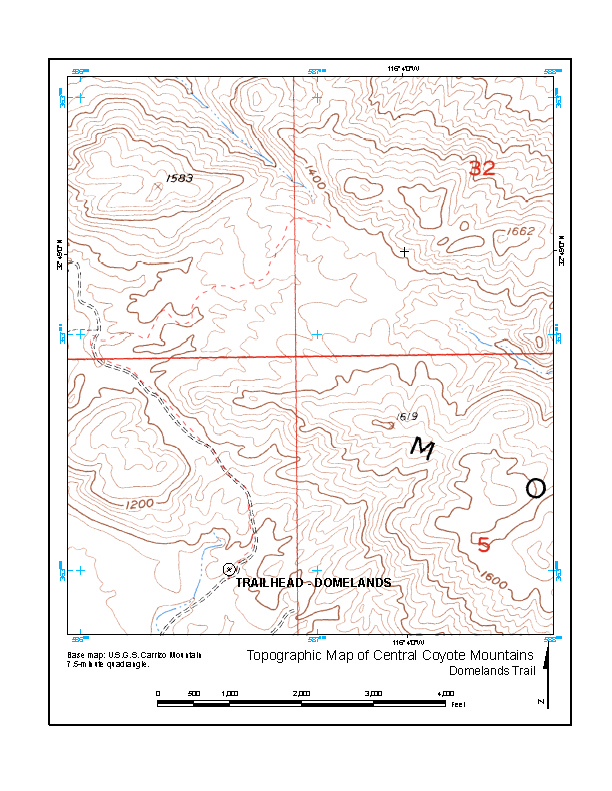
Lower resolution image of PDF downloadable below:
Domelands4.pdf Domelands topographic map for Friday's hike. 0.4 MB [Added 10-17-06]
Lower resolution image of PDF downloadable below:
Domelands4.pdf
Domelands topographic map for Friday's hike. 0.4 MB [Added 10-17-06]
Domelands Geologic Map:
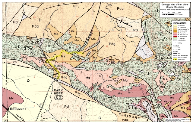
Lower resolution image of PDF downloadable below:
DomelandsGeol2.pdf
Domelands geologic map for Friday's hike. 2.7 MB [Added 10-26-06]
Handouts for Domelands hike:
Published March 16.pdf
Domelands hike description. 0.8 MB [Added 10-26-06]
Flamingo Nests in the Coyote Mountains2.pdf
Phil's description of part of Alpine Valley. 1.1 MB [Added 10-26-06]
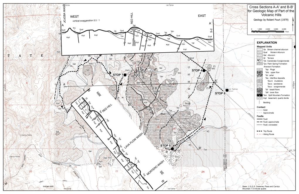
Lower resolution image of PDF downloadable below:
VH_11by17XC.pdf Cross sections A-A' and B-B' redrafted from Robert Fourt's MS thesis map. (Cross sections redrafted by Phil Farquharson.) 2.7 MB [Added 10-7-06]
PDFs for reference only:
Lower resolution image of PDF downloadable below:
Overview2_0.pdf 3.3 MB [Added 9-24-06]
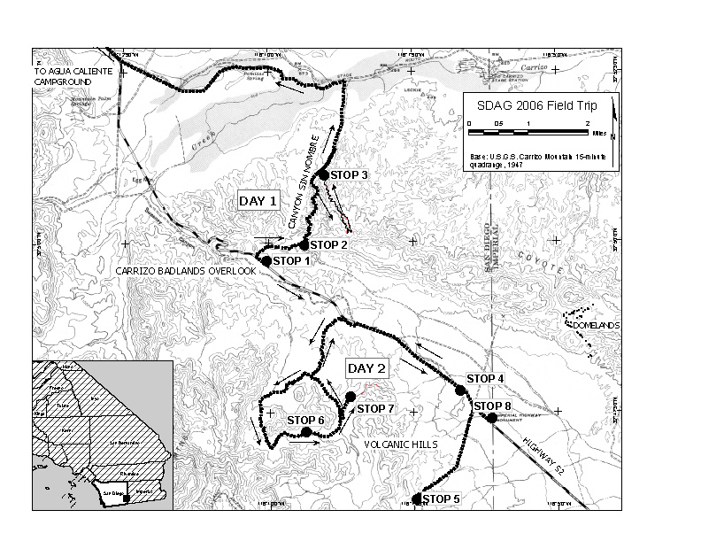
Lower resolution image of PDF downloadable below:
Overview3.pdf 2.3 MB [Added 9-24-06]

Lower resolution image of PDF downloadable below:
VolcanicHills3.pdf 1.2 MB
[Added 9-24-06]
Charlie's Discussion:
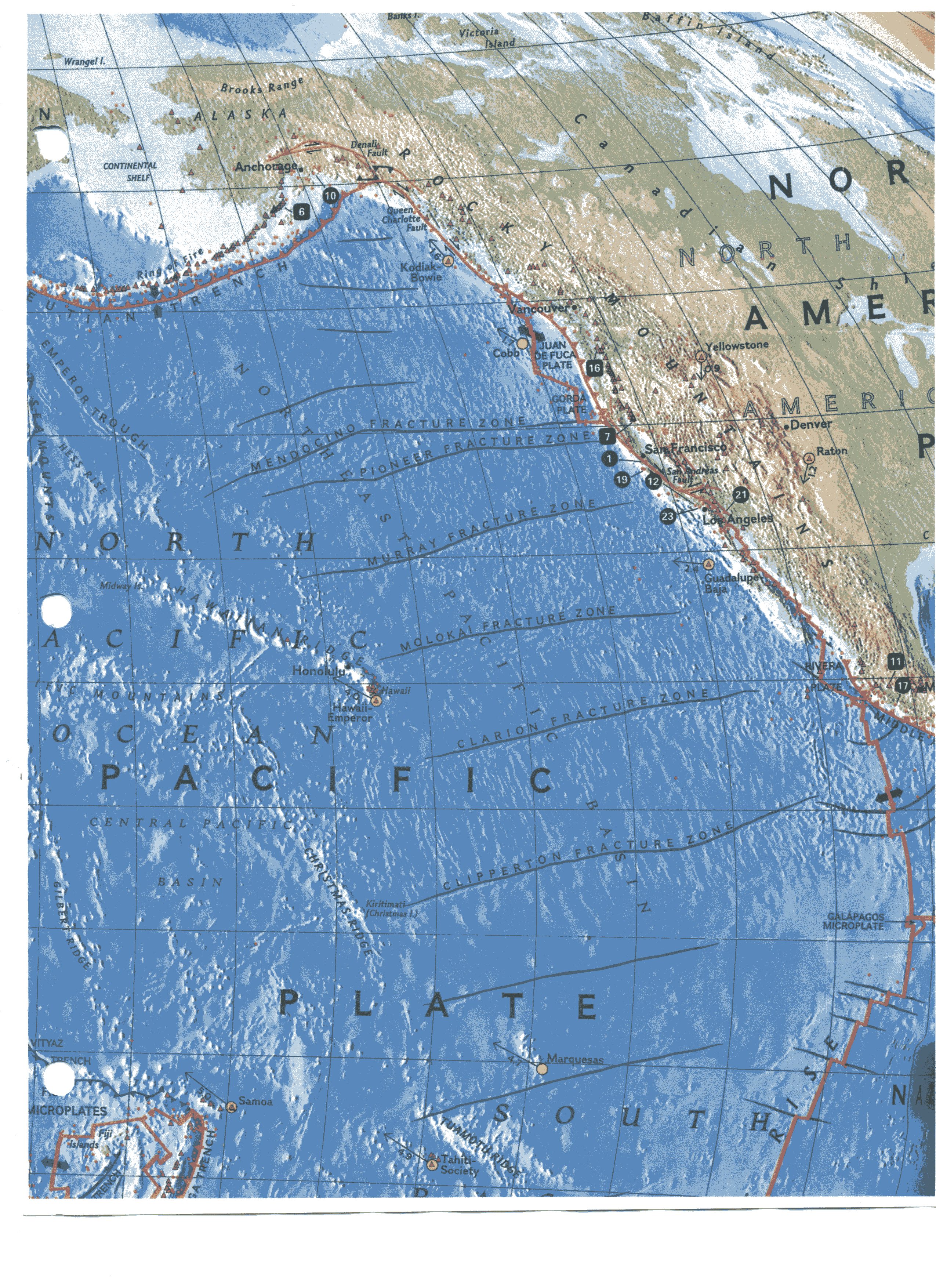
Pacific plate.jpg 2.6 MB Overview
of the Pacific Plate
[Added 10-26-06]
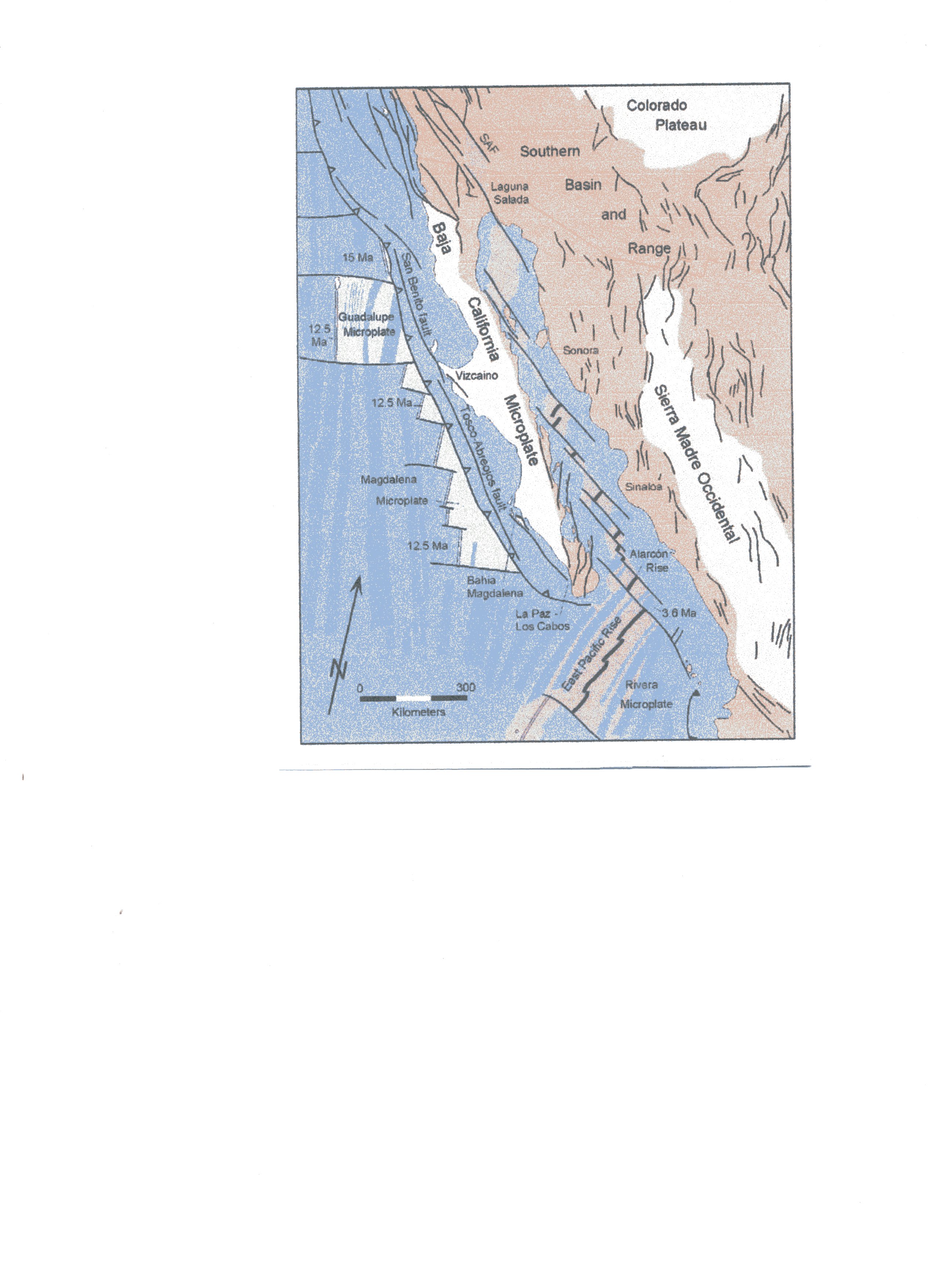
Baja CA faults.jpg 1.0 MB Western
North America fault overview
[Added 10-26-06]
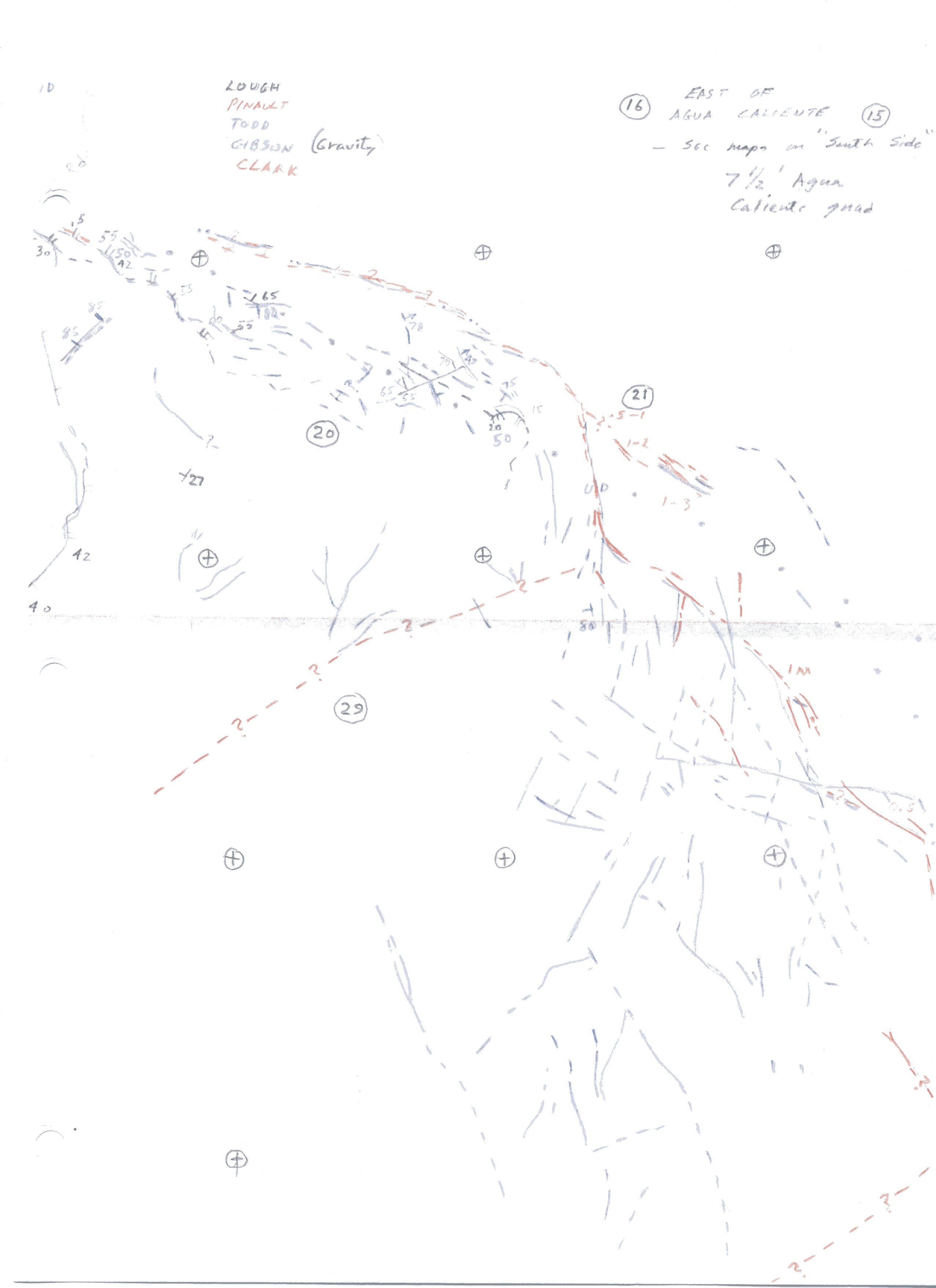
east of Agua Caliente.jpg 0.4 MB
Fault patterns east of Agua Caliente
[Added 10-26-06]
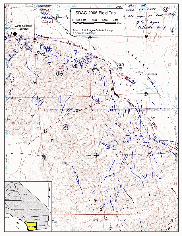
Lower resolution image of PDF downloadable below:
AC.pdf
Fault Map of area east of Agua Caliente Springs. 1.1 MB [Added 10-26-06]
Monte's Handout:
MarshallHandout1.pdf 0.5 MB Three-page handout at
stop 1
[Added 10-26-06]
MarshallHandout2.pdf 1.1 MB Two short articles by John
Crowell on the San Andreas Fault
[Added 10-26-06]
MarshallHandout3.pdf 0.5 MB
Three additional figures on southern California tectonics
[Added 10-26-06]
Created 10/5/06, revised 10/26/06 5:24 am