The second day will be devoted largely to various aspects of Cenozoic volcanism and glacial geology, geomorphology, recent earthquakes, a Paleozoic pendant in the Sierra, the Pine Creek Mine tour (for Group B only) and a bit of Sierran granitoids. We will travel as far north as Convict Lake and Hot Creek, the latter a delightful rest and play stop, though somewhat sulfurous (bring your bathing costume).
For the next two-and-a-half days, we will be in the central eastern Sierra Nevada, White-Inyo area. This area has been mapped at one inch per mile scale. Published geologic map coverage is shown in Figure 8.
![]()
GROUPS A & B
| Return to Big Pine - at junction of Crocker Street and 395, turn left and note odometer. | |||||||||||||||||||||||||||||||||||||||||||||||||
| 0.0 (0.0) | Intersection of Crocker Street and Highway 395. | ||||||||||||||||||||||||||||||||||||||||||||||||
| 1.8 (1.8) | At Reynolds Road, the rugged profile of the Sierran Palisade Crest is visible at 8-9:00. | ||||||||||||||||||||||||||||||||||||||||||||||||
Again, we see the profile of the Coyote Warp on the west side of the highway (Fig. 9).
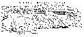 The Coyote Warp is that portion of the east front of the Sierra Nevada, from Big Pine to Bishop Canyon, which has experienced bending or warping. This is in sharp contrast to the steep fault scarp faces of the eastern Sierran front both south and north of the Coyote Warp. This interpretation is supported by well data in the Owens Valley which indicates that the alluvial fill of the valley varies from nearly zero on the west to several thousand feet beneath the east edge of the valley. The Coyote Warp is that portion of the east front of the Sierra Nevada, from Big Pine to Bishop Canyon, which has experienced bending or warping. This is in sharp contrast to the steep fault scarp faces of the eastern Sierran front both south and north of the Coyote Warp. This interpretation is supported by well data in the Owens Valley which indicates that the alluvial fill of the valley varies from nearly zero on the west to several thousand feet beneath the east edge of the valley.
| |||||||||||||||||||||||||||||||||||||||||||||||||
| East of the highway are the three radio telescopes of the Caltech Radio Astronomy facility. The largest of these discs is 150 feet in diameter. | |||||||||||||||||||||||||||||||||||||||||||||||||
| 5.7 (7.5) | At 11:00 we can see the profile of an interrupted alluvial fan surface. The abrupt western face of the profile is a fault scarp, a result of "mountain-down" faulting, producing a small graben between the main front of the Sierra and this fault. | ||||||||||||||||||||||||||||||||||||||||||||||||
| 4.1 (11.6) | Mt. Tom (13,652'), the large pyramidal peak, is ahead on the left; the Wheeler Crest to the north. | ||||||||||||||||||||||||||||||||||||||||||||||||
| 3.6 (15.2) | In Bishop, intersection of 395 and Line Street. | ||||||||||||||||||||||||||||||||||||||||||||||||
| GROUP B, skip ahead to page 31 of guidebook for road log to Pine Creek Mine. | |||||||||||||||||||||||||||||||||||||||||||||||||
| GROUP A, turn left on Line Street, proceed west, staying on the main road (Bishop Creek Road). | |||||||||||||||||||||||||||||||||||||||||||||||||
| 5.1 (20.3) | STOP 9, just before isolated hill on north side of road. Walk west to the outcrops. This is "Knopf's Knob," a very unusual exposure of columnar jointed granitic rock, intruded by Pleistocene olivine basalt. The basaltic intrusion, probably at a temperature of 1,100° C, has produced glass at its contacts with the Triassic Tungsten Hills quartz monzonite, and as much as seven feet from the contacts. The basalt contains numerous xenoliths of quartz monzonite, especially near the intrusive contacts. Most surprisingly, the granitic body has, during cooling following the basalt intrusion, assumed the columnar jointing pattern, typical elsewhere of surficial or shallow igneous rocks, without losing any of its other granitic characteristics (Knopf, 1938). | ||||||||||||||||||||||||||||||||||||||||||||||||
| If you are inclined to collect samples of the glass, there are numerous fragments in the rubble at the base of the hill. Do not collect from the bedrock outcrops. | |||||||||||||||||||||||||||||||||||||||||||||||||
| Looking south across the Bishop Creek Road, we can get another view of the Coyote Warp, here plunging toward us. | |||||||||||||||||||||||||||||||||||||||||||||||||
| Looking directly west, up Bishop Creek Canyon, the irregular barren hills are a large terminal moraine complex of Tahoe age. This is a good place to introduce the classical Sierra Nevada glacial chronology. | |||||||||||||||||||||||||||||||||||||||||||||||||
| |||||||||||||||||||||||||||||||||||||||||||||||||
| Proceed up the Bishop Creek Road. | |||||||||||||||||||||||||||||||||||||||||||||||||
| 3.5 (23.8) | STOP 10, on left side of road. Here we can see, in the roadcut, a cross section of a typical Sierran (Tahoe) moraine, a very heterogeneous mixture of very coarse and fine material. | ||||||||||||||||||||||||||||||||||||||||||||||||
Looking directly west at the Sierran face, we can see small lateral moraines and irregular terminal deposits in two of the small canyons. The high pyramidal peak to the northwest is Mt. Tom (13,652'). The dark brown rocks are largely metasedimentary rocks of the Pine Creek pendant
(see Fig. 12).
 To the north of Mt. Tom is the Wheeler Crest; the east face of both of these marks a major frontal fault and is in sharp contrast to the Coyote Warp to the south. The broad, flat-topped mountain to the left (south) of Mt. Tom is Basin Mountain (13,240'), and to the left of it the prominent, irregular pyramid is Mount Humphries (13,986').
 | |||||||||||||||||||||||||||||||||||||||||||||||||
| To the north, we can see the south-facing scarp of the Volcanic Tableland. The tableland marks the surface of the Pleistocene (710,000 years) Bishop Tuff. The escarpment is not a fault face, but rather an erosional scarp produced by the Owens River. Numerous north-south trending faults, each of which is down on the west, can be seen cutting the tableland surface. | |||||||||||||||||||||||||||||||||||||||||||||||||
| As we proceed up the highway, and after the broad sweeping curve to the right, note the irregular (poorly developed) loop moraines which lie within the valley between the main Tahoe lateral moraines. These are recessional moraines of Tioga age. | |||||||||||||||||||||||||||||||||||||||||||||||||
| 1.2 (25.0) | Turn right, immediately beyond Forest Service kiosk and proceed up the dirt road (Sand Canyon). | ||||||||||||||||||||||||||||||||||||||||||||||||
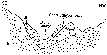
| 1.5 (26.5) | STOP 11, in parking space at Bishop Aqueduct. Here we will walk a short distance west on the road to view some of the geomorphic wonders of Round Valley and the Volcanic Tableland
(Fig. 10).

| ||||||||||||||||||||||||||||||||||||||||||||||||
| Looking north from our viewpoint, we can see, from the left to right, the Wheeler Crest, Round Valley, and the broad surface of the Volcanic Tableland (Bishop Tuff). Although impossible to prove by observation from here, the Bishop Tuff surface is broadly arched about a north-south axis, and it is known to plunge southwestwardly under the alluvium of Round Valley. On the west side of the tableland, we can see the erosional gorges of Rock Creek (left) and the Owens River (right). These streams traverse the Bishop Tuff surface in essentially north-south courses, while the tuff surface plunges southwestwardly toward Round Valley. Clearly, they could not have established north-south paths unless the tableland had such a slope. Therefore, the establishment of their north-south courses must pre-date (antedate) the arching of the Bishop Tuff surface. Such streams are termed by geo-morphologists, antecedent streams. There can be very few places in the world where you can see two antecedent streams - a rare kind of stream - in one view. A bargain, indeed. | |||||||||||||||||||||||||||||||||||||||||||||||||
| In the road cuts at our back at this place, we can see good examples of varying degress of chemical weathering on different types of glacial boulders within the morainal material. One of the qualitative techniques for establishing relative ages of glacial moraines is to determine the degree of chemical weathering on boulders of similar lithology in different till deposits. On our way back down to the main road, we will stop in Sand Canyon to test one aspect of this technique. | |||||||||||||||||||||||||||||||||||||||||||||||||
| From our present viewpoint, we can again see the eroded edge of the Bishop Tuff, and this will be a good place to wax poetic, borrowing extensively from Lipshie (1976), on the general characteristics of the tuff: | |||||||||||||||||||||||||||||||||||||||||||||||||
|
|||||||||||||||||||||||||||||||||||||||||||||||||
| Estimates of the duration of the Bishop Tuff eruption have varied from centuries to only a few hours or days. No significant erosional reworking between units of the tuff and the lack of more than a basal air-fall ash deposit tend to support the latter view. | |||||||||||||||||||||||||||||||||||||||||||||||||
Return to the vehicles, turn around and proceed a short distance down Sand Canyon to STOP 11a. Sand Canyon is a fosse, a valley lying between two parallel lateral moraines
(Fig. 11).
 The ridge on our left (north) is the older Tahoe lateral moraine, and is characterized by a lesser boulder population density than the right hand ridge, which is made up of the younger Tioga lateral moraine. If the sun angle is right, we will also be able to discern many more fresh, unweathered (shiny) boulders on the Tioga moraine, as it has been subjected to a much shorter period of weathering than has the Tahoe.
 | |||||||||||||||||||||||||||||||||||||||||||||||||
| Continue down Sand Canyon to Bishop Creek Road. | |||||||||||||||||||||||||||||||||||||||||||||||||
| 1.5 (28.0) | Turn left on Bishop Creek Road. Proceed to Ed Powers Road, just east of Knopf's Knob. | ||||||||||||||||||||||||||||||||||||||||||||||||
| 4.8 (32.8) | Ed Powers Road, turn left (north). Proceed north toward Highway 395. | ||||||||||||||||||||||||||||||||||||||||||||||||
| 2.4 (35.2) | Highway 395, turn left (west) and proceed toward Pine Creek. As we approach the front of the Sierra, we can again see, from left to right, Mount Humphries (13,986'), Basin Mountain (13,240'), Mt. Tom (13,652'), and the Wheeler Crest. | ||||||||||||||||||||||||||||||||||||||||||||||||
| 3.7 (38.9) | Entering Round Valley. On the west side of the valley, a view of the Pine Creek lateral moraines (Plate 8). The major fault fronting the Sierra at the base of the Wheeler Crest and Mt. Tom sweeps to the southwest, northwest of the Coyote Warp and toward upper Bishop Creek Canyon. | ||||||||||||||||||||||||||||||||||||||||||||||||
| 1.5 (40.4) | Pine Creek Road. Turn left and proceed west. Wheeler Crest on right at 12-2:00. | ||||||||||||||||||||||||||||||||||||||||||||||||
| 3.1 (43.5) | Town of Rovanna, the company town of the Pine Creek Mine. | ||||||||||||||||||||||||||||||||||||||||||||||||
| 0.3 (43.8) | Entering the "canyon" flanked by Tahoe lateral moraines. | ||||||||||||||||||||||||||||||||||||||||||||||||
| 0.6 (44.4) | Passing inset Tioga moraines. | ||||||||||||||||||||||||||||||||||||||||||||||||
| 5.4 (49.8) | The contact of the Triassic Tungsten Hills quartz mon-zonite and late Paleozoic quartzite (dark brown) is on both sides of the road. The quartz monzonite can be seen as well on the far side of the pendant
(Fig. 12).
| ||||||||||||||||||||||||||||||||||||||||||||||||
| 0.2 (50.0) | Pine Creek Park Station. STOP 12. Here, we are on our own while waiting for the mine tour to end. Nothing specifically is planned for this stop, but feel free to wander around at will, but remain in earshot of the vehicle horns. | ||||||||||||||||||||||||||||||||||||||||||||||||
Here the guidebook returns to Bishop, in order to lead the early rising group (Group B) from Camp Inyo to the Pine Creek Mine. And, to wake them up, we begin with a discussion, by Bruce Bilodeau, of the geology of the Pine Creek Mine.