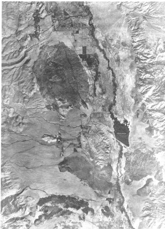
Photo mosaic of part of Owens Valley, south of Big Pine. The Big Pine volcanic field is well shown on both sides of the valley in south part of mosaic; Poverty Hills lie just west of Tinemaha Reservoir; other features of note: alignment of Crater Mountain and Red Mountain (with perlite dome between) along fault; the prominent 1872 fault scarp cutting the east flank of Crater Mountain and a small cinder cone to the south; faulted front of the Inyo Range in upper right of mosaic; elongate Tahoe lateral morainal ridges, along Big Pine Creek on upper left of mosaic. Mosaic courtesy of L.A. Department of Water and Power.