| 1.2 (119.4) | Turn left on Abbott Drive - STOP 4 - view of pediment surface to southwest (Fig. 3)
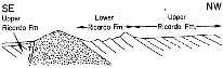 . A pediment is an erosional surface, in this case clearly truncating the upturned edges of the Ricardo beds. The surface has been significantly eroded subsequent to its formation following uplift of the El Paso Range. For the terminology buffs in the group, some geomorphologists have termed this type of pediment a "parapediment," because it has been cut across rocks different from the bedrock of the range to which it "belongs." That is, it belongs hydrologically to the Sierra Nevada lying to the northwest, whose bedrock is much more resistant granitic rocks. . A pediment is an erosional surface, in this case clearly truncating the upturned edges of the Ricardo beds. The surface has been significantly eroded subsequent to its formation following uplift of the El Paso Range. For the terminology buffs in the group, some geomorphologists have termed this type of pediment a "parapediment," because it has been cut across rocks different from the bedrock of the range to which it "belongs." That is, it belongs hydrologically to the Sierra Nevada lying to the northwest, whose bedrock is much more resistant granitic rocks. |
| | Return to Highway 14 and proceed north. |
| 2.8 (122.2) | As the highway turns right at top of grade, we might engage in a game (as suggested by Sharp, 1976). The highway before is straight for a number of miles and you may be interested in testing your powers of distance perception in a desert environment. |
| 0.9 (123.1) | If that game bores you, you may wish (1) to go back to sleep, (2) you had gone to the beach instead of into the desert in September, or (3) to look at 2:00 at Black Mountain, which is capped by highly desert-varnished basalt. |
| | As we travel along this straight stretch, you will note that the Sierran front is gradually approaching from the left. This marks the northeast-southwest trend of the Sierra Nevada fault (See Trona Map Sheet). |
| 7.3 (130.4) | Robber's Roost Cafe on left. At 11:00 are isolated knobs of granitic bedrock, surrounded and partially buried in alluvial fan deposits. These are inselbergs, or "island mountains," left as erosional remnants as the mountain front of which they were a part has retreated westward. |
| 2.6 (133.0) | Crossing Freeman Gulch. Beyond Freeman Gulch, at 11:00 is a gray patch of rocks. These are a pendant of metasedimentary rocks (probably Paleozoic) and early Mesozoic basic intrusives surrounded by younger Mesozoic granitics. |
| 1.4 (134.4) | Isabella Lake Road (Highway 178) on left. Just beyond the Isabella road, note your odometer to check your distance estimate made earlier. |
| 1.3 (135.7) | Indian Wells Valley, Inyokern, and China Lake on the right. The range to the east of China Lake is the Argus Range; the part we see is composed entirely of Mesozoic granitic rocks. |
| 1.5 (137.2) | Inyokern Road to right. |
| 2.7 (139.9) | Ahead and at 11:00 in distance, we can see several of the volcanic flows and cones near Little Lake, at the southern end of the Coso Range. |
| 1.4 (141.3) | Junction with Highway 395. |
| 1.7 (143.3) | Grapevine Canyon on left. The rugged peak at 9:15 is Owens Peak (8,475'). |
| 5.5 (148.5) | Inyo County Line. |
| 3.5 (152.9 | Lumber Mill on right. Beyond the mill on the right and for the next several miles, we will be subparallel to an imposing cliff of basaltic lava. In several places, we can also observe, especially just beyond the railroad crossing ahead, that basalt occurs at the level of the highway as well. In some respects, the cliff has the appearance of a fault scarp, with the basalt at highway level representing the down-dropped side. At the next stop, just south of Little Lake, we will observe closer at hand some of the volcanic features and test this hypothesis. |
| 2.6 (154.6) | Railroad crossing. In this area, basalt outcrops occur at the level of the highway. |
| 3.6 (158.2) | Turn left to Little Lake. |